
For landscape architects
Walk the site before it's built.
Take a photo at every point you want on the plan: along a proposed trail, at a view to keep, at a tree to protect. Every point comes back with its photo, pinned where you took it.
Bed established. Mulch in good shape.
Pinned where you took it
What you'll use it for.
Site inventory and analysis
Existing conditions, trees, turf and hardscape, each photo pinned where you stood.
Trail and route layout
Walk the route and take a photo at each point. The points go into your CAD drawing, the photos into the presentation.
Tree surveys
A photo of each tree's condition at its spot, for protection plans and permits.
Construction observation
Findings on your plan sheets, visit by visit, through to the final walk.
From the field.
Browning and showing signs of stress. Review and adjust the irrigation schedule.
Gap opening between the column and the wall.
Weeds and volunteer willow in the swale. Clear it.
Real site photos. The findings written under them are examples.
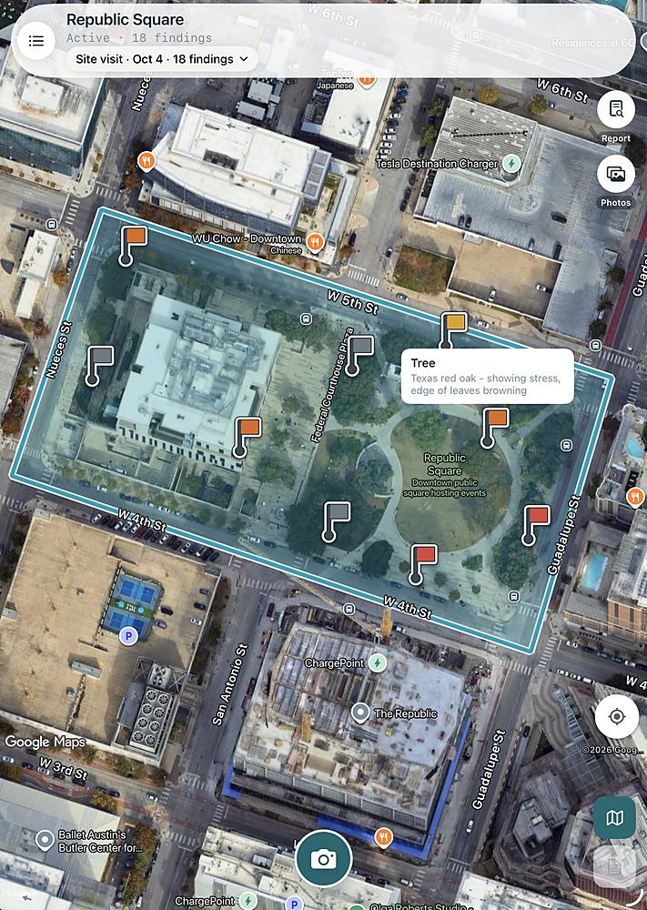
Every finding, on the map.
Each tree, bed and wall you photograph is pinned where you stood, inside the property boundary. Tap a pin to see its finding.
Export photo locations.
Writes the visit as a .zip: a spreadsheet (.xlsx), a point file (.csv) and the photos, numbered in the order taken, each with its GPS location and finding.
Choose the State Plane zone your drawings use and every point gets Easting and Northing for CAD. Use the points and their photos in presentations, design layouts and renderings.
Your next site walk can end with a completed report.
Standard $25 a month. Pro $35 a month, starting with a 14-day free trial.